Poonch Town and Its Strategic Location
Poonch Town is located on the Line of Control, on the confluence of the Poonch river and Betar Nalah. 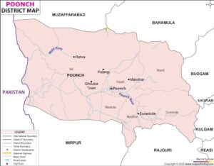 While the Poonch river originated from the Pir Panjal Range on the Indian side, the Betar Nalah originates in POK. The former flows from East to West, and the latter from North to South and Poonch town nestles in the bowl formed at the junction of the two.
A prominent mountain ridge line emanates from the Pir Panjal and slopes down into the Betar Nalah, shielding the Poonch town from the prying eyes of the Pakistani posts. Across the Pir Panjal Range lies the beautiful meadows of Gulmarg.
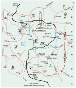 In 1947-48, the embattled garrison at Poonch, which bravely withstood the Pakistani onslaughts, was provided relief by the Indian Army columns from Rajauri and Hajipir. Somehow, Hajipir, a strategic mountain pass on the Pir Panjal range, was allowed to remain in POK. In the 1965 War, the Indian Army captured Hajipir Pass, but it was returned in the post-war parleys.
There are five major pirs in the area, of which three: Thanpir, Ratanpir and Nabapir are on our side and two: Hajipir and Taulipir are in POK. Pirs are sufi saints who believed that the only way to reach God was through devotion and love. All five pirs, who are long gone, are revered and enjoy a huge following among the locals on both sides of the Line of Control; so much so that people would cross over to the other side of the Line of Control to pray at their shrine and seek their blessings till the 1965 War. Now of course, it is unthinkable!
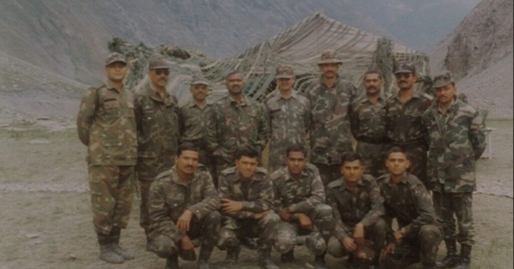
I was posted in Poonch in the late 1980s, and it was all good except for sporadic firing which would take place between the two armies. Nevertheless, our guard was always up! As a youngster there, I have many stories to share; the first one that I will share with you was inspired by a Mile stone.
Pre-1947, there used to be a road from Poonch to Srinagar via Gulmarg, and in those days, a car/bus could cover the distance in six hours. Post 1947-48, with the creation of POK, Poonch to Srinagar would mean two full days via Jammu in the fastest mode of transport and four full days in an Army Convoy.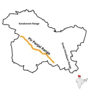
Just short of the Line of Control, on the old Poonch-Srinagar road, is a milestone that reads: Hajipir- 42 km. One day I happened to see it and it got me thinking: I got a map and checked if one could trek across the Pir Panjal Range from Poonch to Sringar; I knew of Rear Area Security patrols and inter formation patrols but did not want to move from one army post to another.
The map indicated that I would have to move to Saujiyan and start trekking up the mountains. I could also make out from the map that one could trek the Chor Panjal Pass located at an approximate height of 13,000 feet to cross over into the valley, trek down to Gulmarg, and Srinagar would be a couple of hours away by bus.
An Idea Fueled by Youthful Adventure
The spirit of adventure and the impetuosity of youth took over as the idea of trekking across to Srinagar started appealing more & more.
I walked upto the Adjutant of my battalion and told him that I wanted to trek across to Sringar and requested for a week’s leave.
He smiled and told me that there was very thin line between audacity and foolhardiness but seeing the determination on my face advised me to take my buddy along adding that the Gorkha Johnny, born to the mountains, would be an asset during the trek.
My leave was sanctioned and I planned to move on Sunday, a dry day, which meant no vehicle of the battalion would ply on that day.
I was mentally prepared to bus it to Saujiyan but on a lark decided to request the Adjutant for a vehicle. To my pleasant surprise , he detailed a good old 1Ton lorry which chugged its way to Saujiyan and dropped us off at around 1000 hrs.
I was carrying some clothes, packets of maggi noodles, water bottle and a bottle of brandy (as medicinal comfort!) in my fancy rucksack, which I had got from Nepal. My buddy was carrying some stuff, less the bottle of brandy, in his army-issued Pack 08.
We started our trek around 1015 hrs following the track pointed out to us by the locals. The confidence of youth had overlooked the need to plan the trek on a map, way points, halts, acclimatisation (we started our trek from approximately 2000 feet and had to trek up to approximately 13,000 feet on the same day!), time planning, and communication in case of any emergency.
The bliss came not from ignorance but from a heady cocktail of youth and adventure.
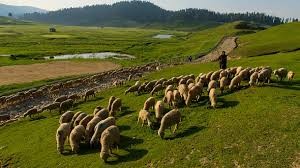 As we climbed, the foot track turned into trails, but we could still take our directions from the Bakarwals grazing their sheep. As we climbed higher, the Bakarwals too, were left behind, and it was just the two of us trekking up to Chor Panjal Pass minus the map and compass.
Around 1600h, my buddy, who was ten years older than me, started feeling giddy and started gasping for breath; the adverse effect of high altitude had kicked in. My cocky confidence yielded to concern as I remembered an old fauji saying about high altitude areas: ‘don’t be a Gama in the land of Lamas’. I also remembered that Hypoxia, lack of oxygen, could impact anyone regardless of fitness level.
I got him to sit for a while and drink some water. After some time he decided to get up and recommence the trek.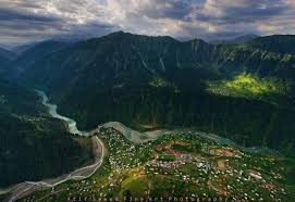
We were moving slowly now because there was no way out in case of a medical emergency. As we closed up to the pass, it became dark, and it started to drizzle. I asked my buddy in case he wanted to halt, but manfully he shook his head, though I could see tiredness and physical strain writ large on his face.
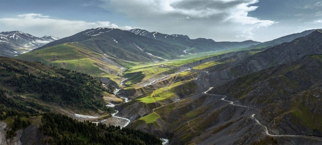
In half an hour we were at the pass and even though it was almost dark and we wanted to descend fast to a lower altitude, I could not help but admire the beauty of Kashmir valley: thick fir forests, lovely green meadows, and lakes in the far distance.
Finding Shelter at Night
Regardless of night having fallen, we were literally ran down the slopes to lose height, and as we did so, my buddy felt better.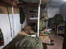
In the far distance, we spotted a flicker of light and started walking towards it. Fortunately, it turned out to be a BSF post, though the sentry was not convinced that the tall, gangly man in a pair of Shorts and T-shirt was an Officer who had trekked across from Poonch with his buddy.
He double checked my identity card before letting us into a dark, dingy, and cold bunker. We prepared and ate Maggi and took two shots of brandy, which gave us the warmth to sleep on the makeshift bed of wooden planks.
Early next morning, we started for Gulmarg. About two hours into our trek, we found three bearded, young men trying to close in on us rapidly. I had a sense of unease as we knew nobody in the area.
They turned out to be from a village near my post in Poonch and had recognised me from far! They insisted on carrying our rucksacks and left us at Gulmarg; I marvelled at their spirit while bidding them farewell.
It was about lunchtime and I decided to walk into the Officer’s Mess of Madras Battalion located on the fringes of Gulmarg.
The Mess Haviladar was loathe to permit an unkempt and unwashed youngster who was in a pair of shorts and a T-shirt, into the ante room.
Luckily, the Commanding Officer, who was about to have his lunch, spotted me and asked the mess Havildar to permit me in. On hearing my story, and choosing to ignore the foolhardy part, he appreciated the spirit of adventure and the audacity of the enterprise!
So much so that he offered me to be his guest for a couple of days before moving to Srinagar.
After a week, I returned to Poonch, but that story will be told some other day.
Written by Maj Gen D.A. Chaturvedi (Retd.)